{ "@context": "https://schema.org", "@type": "ProfessionalService", "additionalType": "https://schema.org/ProfessionalService", "name": "The Adirondack Tool Co. - Plans and Guides", "url": "https://plansandguides.theadktoolco.com", "telephone": "+1-518-241-6407", "image": "https://plansandguides.theadktoolco.com/assets/images/image01.jpg?v=ba0b8303", "logo": "https://plansandguides.theadktoolco.com/assets/images/image01.jpg?v=ba0b8303", "priceRange": "$10-$500", "description": "Escape the office. Own your weekend. The Adirondack Tool Company - Hiking Plans and Guides was founded by two corporate professionals who share a passion for the outdoors. We provide custom hiking and camping itineraries, climbing guides, weather reports, fitness and nutrition plans, gear recommendations, summit flags, trailhead parking reservations, and outdoor adventure planning services throughout the Northeastern United States.", "sameAs": [ "https://share.google/avzDo0f0LbydC7lPd" ], "areaServed": [ { "@type": "State", "name": "New York" }, { "@type": "State", "name": "Vermont" }, { "@type": "State", "name": "New Hampshire" }, { "@type": "State", "name": "Maine" }, { "@type": "State", "name": "Massachusetts" }, { "@type": "State", "name": "Connecticut" }, { "@type": "State", "name": "Rhode Island" }, { "@type": "State", "name": "Pennsylvania" } ], "openingHours": "Mo-Su 05:00-22:00", "keywords": "Adirondack hiking plans, hiking itineraries, backpacking itineraries, camping itineraries, mountain trip planning, Adirondack High Peaks guide, White Mountains hiking guide, Green Mountains hiking guide, Northeast hiking guide, hiking fitness plan, backpacking fitness plan, hiking nutrition plan, outdoor adventure planning, summit flags, trailhead parking reservations, hiking gear list, camping gear list, custom hiking route planning, Adirondacks, Catskills, White Mountains, Green Mountains, Acadia National Park", "hasOfferCatalog": { "@type": "OfferCatalog", "name": "Outdoor Adventure Planning Services", "itemListElement": [ { "@type": "Offer", "itemOffered": { "@type": "Service", "name": "Custom Hiking Itineraries" } }, { "@type": "Offer", "itemOffered": { "@type": "Service", "name": "Camping Itineraries" } }, { "@type": "Offer", "itemOffered": { "@type": "Service", "name": "Custom Gear Lists" } }, { "@type": "Offer", "itemOffered": { "@type": "Service", "name": "Fitness Training Plans" } }, { "@type": "Offer", "itemOffered": { "@type": "Service", "name": "Nutrition Plans" } }, { "@type": "Offer", "itemOffered": { "@type": "Service", "name": "Personalized Weather Reports" } }, { "@type": "Offer", "itemOffered": { "@type": "Service", "name": "Trailhead Parking Reservations" } }, { "@type": "Offer", "itemOffered": { "@type": "Service", "name": "Summit Flags" } }, { "@type": "Offer", "itemOffered": { "@type": "Service", "name": "Partner-Guided Hiking Experiences" } } ] } }

Hiking Plans and Trip Guides

Want to make the most of the great outdoors without stretching your wallet?
We plan your entire trip and give personal insights to every outdoor adventure. Just tell us your goal and time horizon - we do the rest.

Want to make the most of the great outdoors without stretching your wallet?We plan your trip and give personal insights to every adventure. Tell us your goal and time horizon - we do the rest.

Our Mission:

To replace misleading internet forums with personalized, battle-tested blueprints for your most epic adventures.

Popular sites are full of conflicting reviews and exaggerated risks. After more than a decade navigating extreme mountain conditions, we formed The Adirondack Tool Co. to cut through the digital noise.

Just tell us your goal—we’ll provide a definitive game plan on what to bring, where to go, and how to get there.

"You don't need a sherpa for one day in the woods..." - The ADK Tool Co. Team


Trip Selection

Whiteface Mountain

Via Summit Trail

Mount Marcy

Via Van Hoevenberg Trail

Giant Mountain

Via Roaring Brook Trail

Mount Washington

Via Tuckerman's Ravine / Lionhead Trail

Mount Adams

Via Airline Trail

Mount Lafayette / Lincoln

Via Franconia Ridge Trail

Mount Garfield

Via Mount Garfield Trail

Mount Osceola

Via Mount Osceola Summit Trail

Big Slide Mountain

Via Phelps Trail

Mount Haystack

Via Mount Haystack Trail

Mount Moosilauke

Via Beaver Brook Trail

Gothics / Saddleback / Armstrong / Lower & Upper Wolfjaw Mountain

Via Great Range Loop Trail

Wright / Algonquin / Iroquois Peak

Via Algonquin Trail

Mount Colden

Via Trap Dike Route

Cascade / Porter Mountain

Via Cascade Mountain Trail

Killington Peak

Via Bucklin Trail

Mount Monadnock

Via White Dot/White Cross Trail

Your Custom Route

Your Custom Trail


Mount Marcy

Mount Marcy via Van Hoevenberg Trail

Most Marcy guides are written by people who've never left their desk. This isn't that — it's our real itinerary, our real gear, and our real mistake, from our own trip up Van Ho.
* 14.8 mi round trip · ~3,166 ft elevation gain

Our Adventure

- Completed by the ADK Tool Co. on January 21, 2023
- Peak #5 for ADK John · Peak #3 for ADK Damon

What the Internet Doesn't Tell You:

  • The lot at the Adirondack Lodge fills up quick, especially with overnight campers. Arrive early to secure your spot

  • The summit push is no joke. Extra caution needed to navigate the steep descent from the summit

  • Don't let the distance on AllTrails fool you, this hike is 14+ miles long!


Tier 1 - Route Intel - $20

  • Our exact mile-by-mile itinerary from our own summit day — where we stopped, how long each stretch took, what surprised us

  • A Van Ho-specific gear list, shown next to our own summit-day photos

  • The one thing we got wrong on this route, so you don't repeat it

Best For:

First-timers tackling Marcy, or anyone who wants a proven plan instead of piecing one together from forum threads


Tier 2 - Full Send Package - $50

*Everything in Tier 1, plus:

  • A nutrition plan built around our actual calorie burn and timing for a route this long

  • Fitness prep notes specific to Van Ho's sustained climb — not generic 46er advice

  • A fresh weather report pulled the day you order

  • Real photo/video clips from our own summit push

Best For:

Hikers who want the full playbook, start to finish


Add-on - Marcy Summit Flag - $30

You earned it.


Don't see your route? Tell us your goal and we'll build something custom!


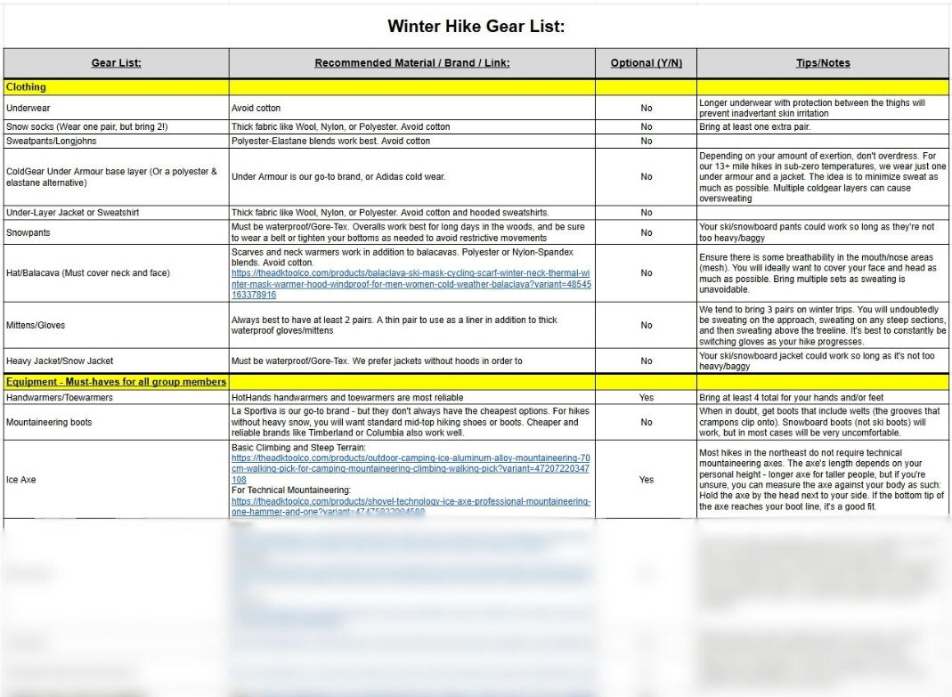
Gear Lists

What You Get:

  • Specific brand recommendations and clothing material to use/avoid

  • A detailed breakdown of how to cut pack weight and be as efficient as possible on the trail

  • Direct gear store links for easy shopping. We promote the most effective products at the best price

Why It Matters:

Carrying the wrong gear leads to heavy packs and dangerous hiking experiences. A tailored loadout removes the guesswork, eliminates overpacking, and keeps you moving safely.

Example:

A redacted nutrition plan used for hiking in the Adirondack Mountains of New York and the White Mountains of New Hampshire. The nutrition plan was customized and created by The Adirondack Tool Co. - Hiking Plans, Guides, and Gear


Giant Mountain

Giant Mountain via Roaring Brook Trail

Roaring Brook is one of the steepest, most direct lines up Giant — a short-mileage route with relentless elevation gain, passing right by Roaring Brook Falls on the way.
* ~7.0 mi round trip · ~3,300 ft elevation gain · Peak #3 for ADK John *

Our Adventure

Completed by the ADK Tool Co. on May 30, 2022

The logo for The Adirondack Tool Co. - Hiking Plans, Guides, and Gear

What the Internet Doesn't Tell You:

  • The ascent is short, but steep and relentless. Factor in some breaks for your legs and fuel/hydration

  • Once you pass Roaring Brook Falls, you'll continue onto a ridge. This section will be more exposed, so be mindful of that


Tier 1 - Route Intel - $20

  • Our exact mile-by-mile itinerary from our own hike — where we stopped, how long each stretch took, what surprised us

  • A Roaring Brook-specific gear list, shown next to our own summit-day photos

  • The one thing we got wrong on this route, so you don't repeat it

Best For:

Hikers who want a shorter-mileage, high-intensity route up Giant, or anyone who wants a proven plan instead of piecing one together from forum threads


Tier 2 - Full Send Package - $50

*Everything in Tier 1, plus:

  • A nutrition plan built around our actual calorie burn and timing for a short, steep route like this

  • Fitness prep notes specific to sustained steep climbing over a shorter distance — not generic 46er advice

  • A fresh weather report pulled the day you order

  • Real photo/video clips from our own summit push

Best For:

Hikers who want the full playbook, start to finish


Add-on - Giant Mountain Summit Flag - $30

You earned it.


Don't see your route? Tell us your goal and we'll build something custom!


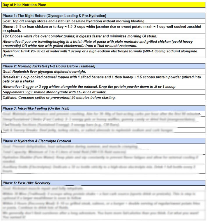
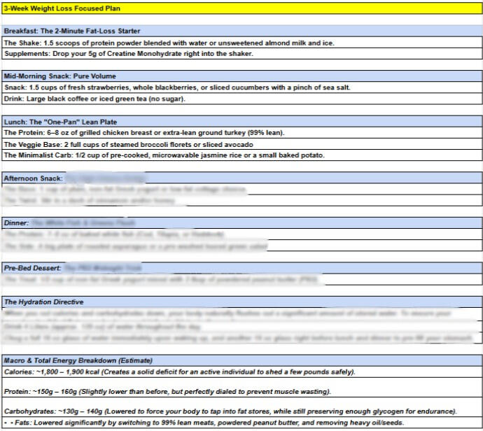
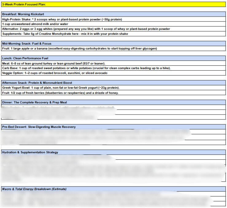
Nutrition Guides

What You Get:

  • Exact meal, snack, and hydration timelines structured around your route’s length, elevation gain, and weather conditions

  • Targeted calorie targets, recovery meal plans, and lightweight food packing strategies for multi-day trips

  • Tailored recommendations matching your personal food preferences, dietary needs, and overall nutritional goals

Why It Matters:

Under-fueling in the mountains leads to sudden fatigue, severe cramping, and failed summits. Proper nutrition maintains peak energy, sharpens focus, and dramatically speeds up recovery between tough hiking days.

Example:

A redacted nutrition plan used for hiking in the Adirondack Mountains of New York and the White Mountains of New Hampshire. The nutrition plan was customized and created by The Adirondack Tool Co. - Hiking Plans, Guides, and Gear


Mount Washington

Mount Washington via Tuckerman Ravine/Lion Head Trail

Mount Washington isn't an Adirondack peak, but it's one of the most legendary - and most dangerous - day hikes in the Northeast. Most guides undersell it. This is our real itinerary, our real gear, and our real mistake, from our own trip up Tuckerman Ravine and Lions Head.
* ~8.6 mi round trip · ~4,400 ft elevation gain]

Our Adventure

Completed by the ADK Tool Co. on March 14, 2026

The logo for The Adirondack Tool Co. - Hiking Plans, Guides, and Gear

What the Internet Doesn't Tell You:

  • Don't be a hero - use your judgement and know when to turn back. The weather can change on a dime

  • The Lion Head trail requires an ice axe and crampons in the winter months. It's worth bringing a rope as well

  • No matter what season you're in, bring extra layers. The summit is cold/windy year-round


Tier 1 - Route Intel - $20

  • Our exact mile-by-mile itinerary from our own summit day — where we stopped, how long each stretch took, what surprised us

  • A Tuckerman/Lion Head-specific gear list, shown next to our own summit-day photos

  • The one thing we got wrong on this route, so you don't repeat it

Best For:

Hikers chasing the Northeast's most iconic (and most dangerous) day hike, or anyone who wants a proven plan instead of piecing one together from forum threads


Tier 2 - Full Send Package - $50

*Everything in Tier 1, plus:

  • A nutrition plan built around our actual calorie burn and timing for a route this long

  • Fitness prep notes specific to the Lion Head scramble and the steep, rocky final push above treeline — not generic advice

  • A fresh weather report pulled the day you order — worth calling out that Mount Washington is genuinely famous for extreme, fast-changing summit weather, so this matters more here than on most routes

  • Real photo/video clips from our own summit push

Best For:

Hikers who want the full playbook, start to finish


Add-on - Mount Washington Summit Flag - $30

You earned it.


Don't see your route? Tell us your goal and we'll build something custom!


Weather Reports

What You Get:

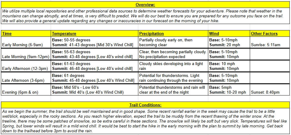
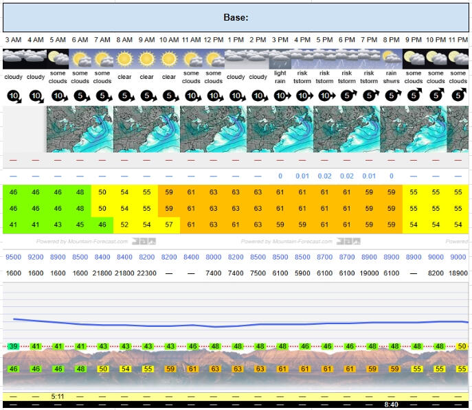
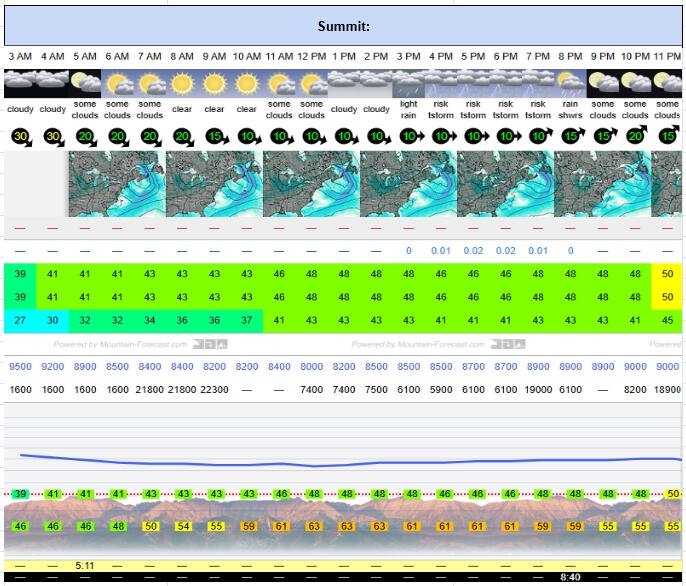
  • Accurate temperature, precipitation, and wind projections calculated for higher elevations

  • Detailed summit timeframes and exact sunrise/sunset windows for safe navigation

  • Early warnings for severe weather, trail conditions, and secondary routes

Why It Matters:

Mountain weather changes rapidly and rarely matches nearby town forecasts. A localized report ensures you pack the right layer system, hit the trail at the right time, and stay safe above tree line

Example:

A weather report used for hiking in the Adirondack Mountains of New York and the White Mountains of New Hampshire. The weather report was customized and created by The Adirondack Tool Co. - Hiking Plans, Guides, and Gear


Mount Lafayette & Lincoln

Mount Lafayette via Franconia Ridge Loop Trail

Franconia Ridge is one of the most iconic ridge walks in the Northeast — three summits, two miles of exposed alpine ridgeline, and views most guides just call "incredible" without telling you what to actually expect underfoot...* ~8.7 mi loop · ~3,800 ft elevation gain · 3 summits (Little Haystack, Mt. Lincoln, Mt. Lafayette) · [note: mileage/gain (8.0–9.1 mi, 3,480–4,258 ft) depends on trail combo

Our Adventure

Completed by the ADK Tool Co. on June 29, 2024

The logo for The Adirondack Tool Co. - Hiking Plans, Guides, and Gear

What the Internet Doesn't Tell You:

  • This is one of the most popular hikes in the White Mountains. The lots in the surrounding areas fill up fast. Plan to start early

  • You will be above the treeline and along a ridge for multiple miles - Wind will always be a factor, so bring extra layers

  • One of the best sunrise hikes in the Northeast - if you're up for the challenge!


Tier 1 - Route Intel - $20

  • Our exact mile-by-mile itinerary from our own loop — where we stopped, how long each stretch took, what surprised us

  • A Franconia Ridge-specific gear list, shown next to our own summit-day photos

  • The one thing we got wrong on this route, so you don't repeat it

Best For:

Hikers chasing one of New England's most popular ridge hikes, or anyone who wants a proven plan instead of piecing one together from forum threads


Tier 2 - Full Send Package - $50

*Everything in Tier 1, plus:

  • A nutrition plan built around our actual calorie burn and timing for a route this long

  • Fitness prep notes specific to bagging three summits in one push — not generic advice

  • A fresh weather report pulled the day you order (the ridge is fully exposed for miles, so conditions matter more here)

  • Real photo/video clips from our own ridge walk

Best For:

Hikers who want the full playbook, start to finish


Add-on - Mount Lafayette/Mount Lincoln Summit Flag - $30

You earned it.


Don't see your route? Tell us your goal and we'll build something custom!


Summit Flags

What You Get:

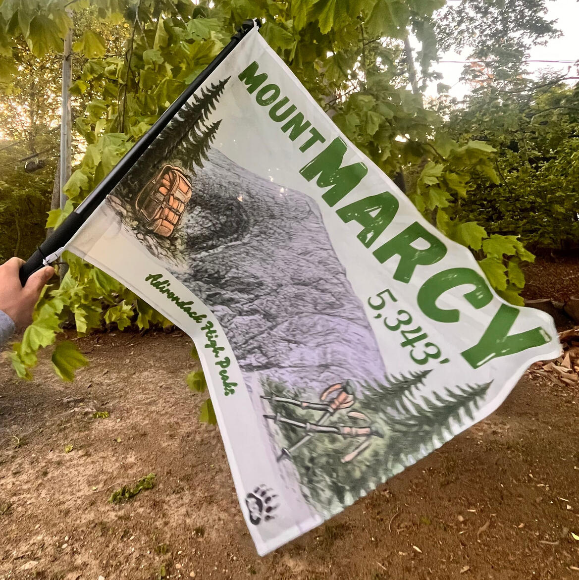
The ultimate summit reward: custom, ultralight mountain flags built to withstand the trail and proudly showcase your highest achievements

Why It Matters:

To flaunt at the top of each summit and capture your core memories/ultimate social media posts

Examples:

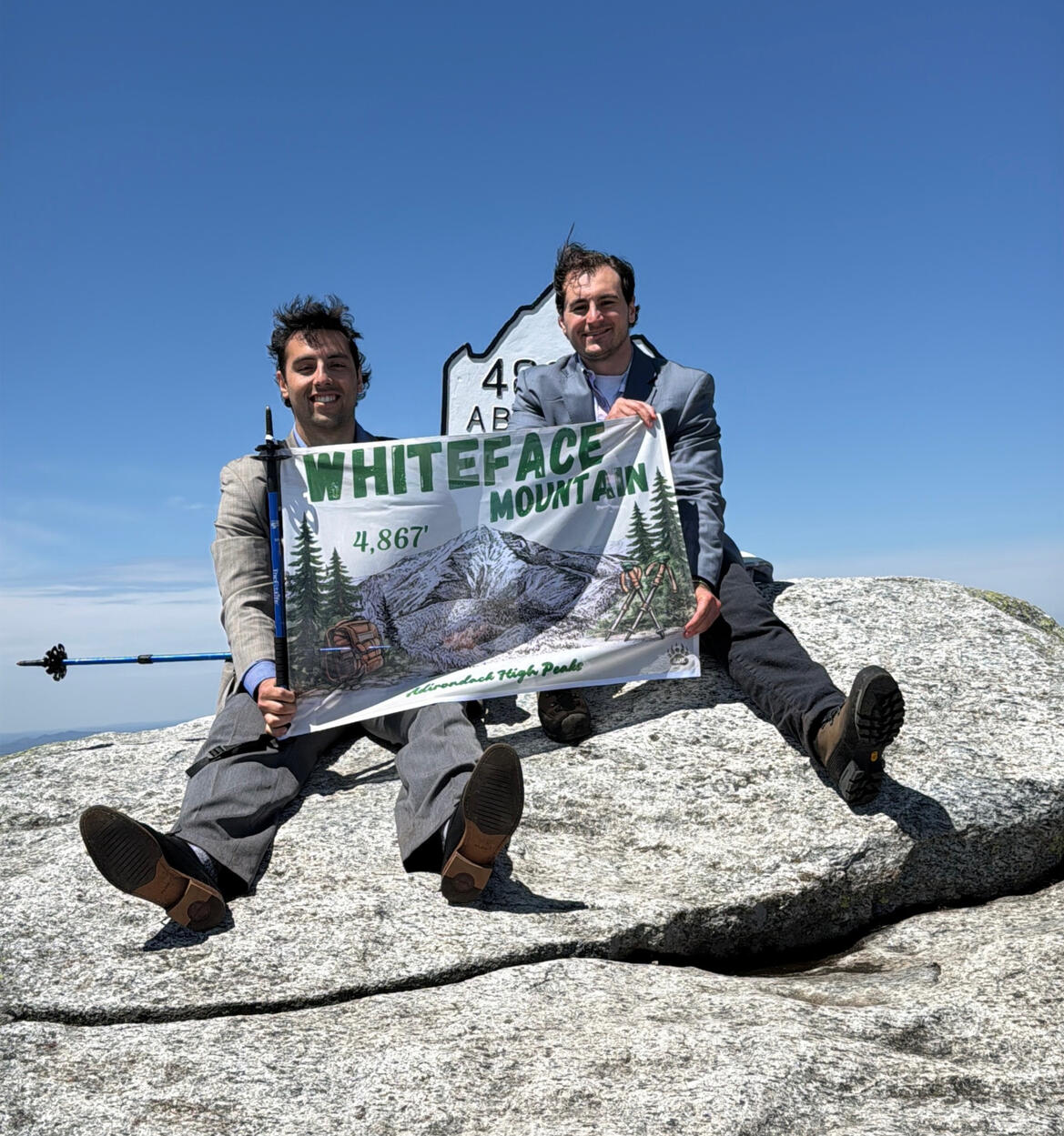
An image of a customized Mount Marcy Summit Flag offered only by the Adirondack Tool Co.
The logo for The Adirondack Tool Co. - Hiking Plans, Guides, and Gear
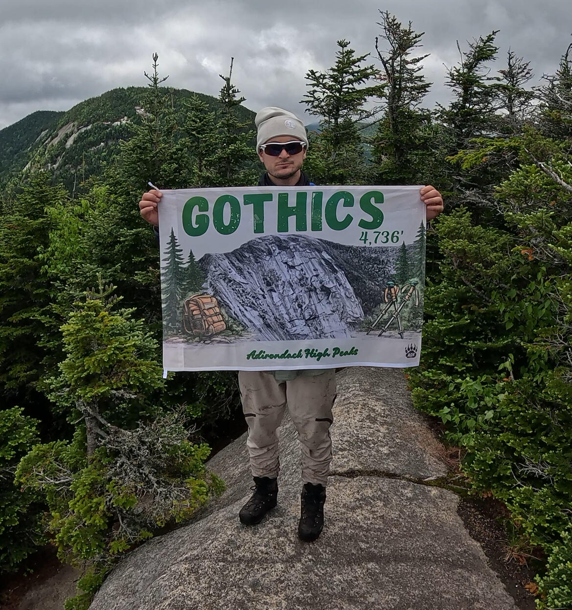
An image of a customized Gothics Peak Summit Flag offered only by the Adirondack Tool Co.

Designs from real mountain photos! Shop flags for all 46 high peaks and more here.

Product Features:

Made with 100% lightweight polyester. Designed with durable double plain stitched edges and side tunnel for hanging. Size: 36''x 24''

Care Instructions:

Machine wash separately: cold (max 30C or 90F), gentle cycle. Non-chlorine: bleach as needed. Tumble dry: low heat. Do not iron or dry-clean


Hiking Itineraries

What You Get:

- Logistics and parking details to make sure you start the day on the right foot
- Pre-determined summit turn-back times based on daylight and weather windows
- Pacing estimates tailored to your group's experience level and pack weight

Why It Matters:

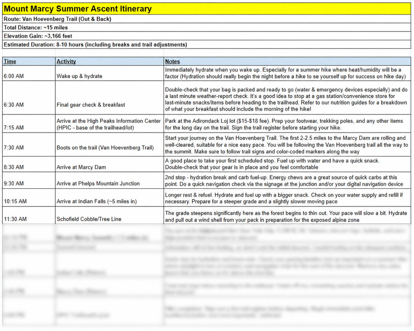
Eliminates guesswork and last-minute trail decisions so you can focus on the adventure with total confidence.

Example:

The logo for The Adirondack Tool Co. - Hiking Plans, Guides, and Gear


Whiteface Mountain

Whiteface Mountain via the Summit Trail

Most Whiteface guides are written by people who drove the toll road. This isn't that — it's our real itinerary, our real gear, and our real mistake, from our own hike up from the ASRC trailhead* 9.8 mi round trip · ~3,664 ft elevation gain
* Peak #7 for ADK John · Peak #6 for ADK Damon

Our Adventure

Completed by the ADK Tool Co. team on May 16, 2026

The logo for The Adirondack Tool Co. - Hiking Plans, Guides, and Gear

What the Internet Doesn't Tell You:

  • The first ~2 miles are tough! Super steep and soft terrain, making for a difficult initial ascent

  • The summit push is long, rocky, and exposed. Make sure you have layers!

  • This is a popular mountain - Many people will drive the toll road to the top. Expect a crowded summit


Tier 1 - Route Intel - $20

  • Our exact mile-by-mile itinerary from our own summit day — where we stopped, how long each stretch took, what surprised us

  • A Summit Trail-specific gear list, shown next to our own summit-day photos

  • The one thing we got wrong on this route, so you don't repeat it

Best For:

Hiking Whiteface the real way (on foot) instead of the toll road, or anyone who wants a proven plan instead of piecing one together from forum threads


Tier 2 - Full Send Package - $50

*Everything in Tier 1, plus:

  • A nutrition plan built around our actual calorie burn and timing for a route this long

  • Fitness prep notes specific to the Marble Mountain climb and the steep, rocky final push to the summit — not generic 46er advice

  • A fresh weather report pulled the day you order (summit weather here changes fast and the exposed rock face gets tricky in wind/rain)

  • Real photo/video clips from our own summit push

Best For:

Hikers who want the full playbook, start to finish


Add-On - Whiteface Summit Flag - $30

You earned it.


Don't see your route? Tell us your goal and we'll build something custom!


Fitness Training Plans

What You Get:

  • Custom full-body programming tailored to your current fitness level and schedule

  • Weekly adjustments to safely build up carrying weight without burnout

  • Recovery and mobility sessions to protect your joints and reduce risk of injury

*** Plans based on a 4-5 day weekly workout schedule. To be adjusted based on experience and preferences ***

Why It Matters:

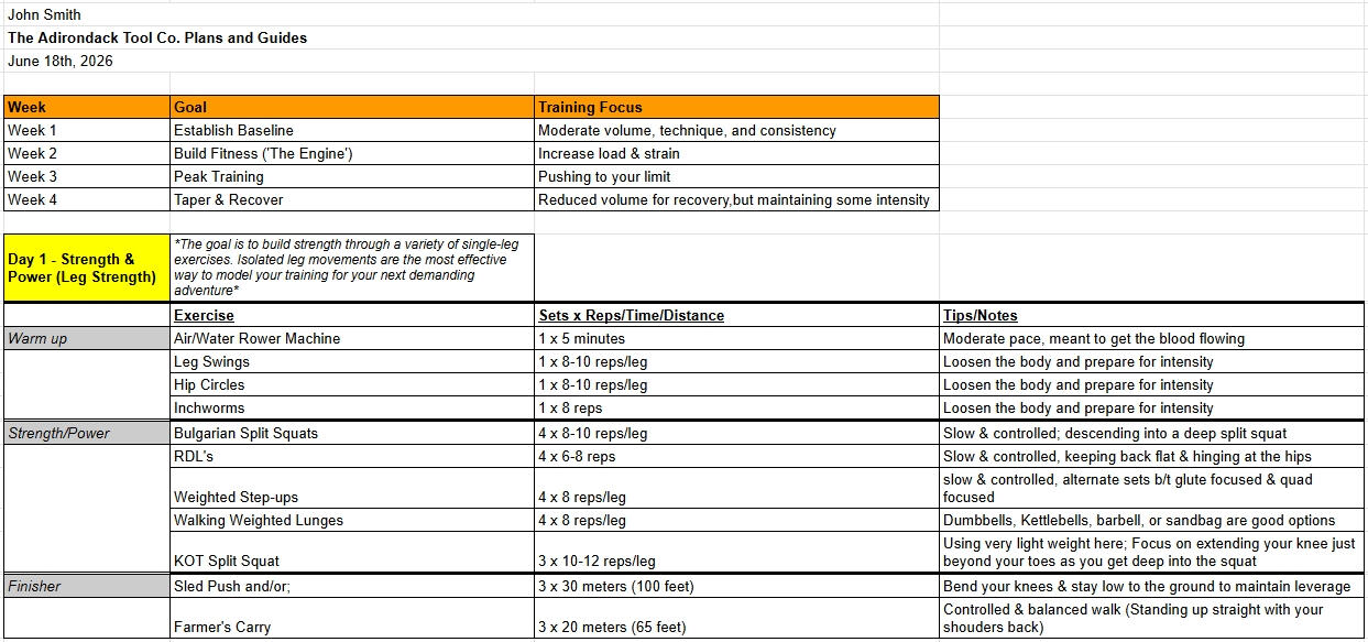
Mountain trekking demands more than basic cardio. Targeted strength and conditioning build stamina, protect your body, and keep you feeling strong through every mile

Example:

An excerpt of a one-week customized fitness plan. The image shows one day of the one-week fitness plan, which was customized and created by The Adirondack Tool Co. - Hiking Plans, Guides, and Gear


Mount Adams

Mount Adams via the Airline Trail

Mount Adams is the second-highest peak in New Hampshire and the entire Northeast — and the Airline Trail is the shortest, steepest, most direct way up.
* 8.6 mi round trip · ~4,500 ft elevation gain *

Our Adventure

Completed by the ADK Tool Co. on February 22, 2025

The logo for The Adirondack Tool Co. - Hiking Plans, Guides, and Gear

What the Internet Doesn't Tell You:

  • There's no easing into this one - It's harsh and steep from start to finish. Be ready to roll with your first step on the trail

  • There's a lot of exposure above the treeline. Get ready to pack on your extra layers for the final summit push

  • The trail is basically straight up. No turns or switchbacks to worry about


Tier 1 - Route Intel - $20

  • Our exact mile-by-mile itinerary from our own hike — where we stopped, how long each stretch took, what surprised us

  • An Airline Trail-specific gear list, shown next to our own summit-day photos

  • The one thing we got wrong on this route, so you don't repeat it

Best For:

Hikers taking on one of the toughest standard routes in the Whites, or anyone who wants a proven plan instead of piecing one together from forum threads


Tier 2 - Full Send Package - $50

*Everything in Tier 1, plus:

  • A nutrition plan built around our actual calorie burn and timing for a route this steep and long

  • Fitness prep notes specific to Airline's sustained, steep climb — not generic advice

  • A fresh weather report pulled the day you order (the exposure here is genuinely dangerous in high wind, and conditions change fast in the Presidentials)

  • Real photo/video clips from our own summit push

Best For:

Hikers who want the full playbook, start to finish


Add-on - Adams Summit Flag - $30

You earned it.


Don't see your route? Tell us your goal and we'll build something custom!


Mount Garfield

Mount Garfield via Garfield Trail

Garfield has a reputation as one of the more approachable 4,000-footers in the Whites — a long, gradual grind through the woods that saves its only real steep push for the final quarter-mile.
* ~9.8 mi round trip · ~3,000 ft elevation gain *
Note: winter hikers should expect closer to 12 mi due to the seasonal Gale River Loop Road closure

Our Adventure

Completed by the ADK Tool Co. on July 27, 2024

The logo for The Adirondack Tool Co. - Hiking Plans, Guides, and Gear

What the Internet Doesn't Tell You:

  • Gale River Loop Road closes and parking shifts to Route 3, adding a road walk that pushes the total closer to 12 mi

  • The foundation of an old fire tower sits atop the summit - A cool and unique feature of this mountain

  • 360 views at the top - including views of a handful of the 4,000 footers in the region


Tier 1 - Route Intel - $20

  • Our exact mile-by-mile itinerary from our own hike — where we stopped, how long each stretch took, what surprised us

  • A Garfield Trail-specific gear list, shown next to our own summit-day photos

  • The one thing we got wrong on this route, so you don't repeat it

Best For:

Hikers looking for an approachable 4,000-footer as an entry point into the Whites, or anyone who wants a proven plan instead of piecing one together from forum threads


Tier 2 - Full Send Package - $50

*Everything in Tier 1, plus:

  • A nutrition plan built around our actual calorie burn and timing for a route this long

  • Fitness prep notes specific to a long, gradual approach with one steep finishing push — not generic advice

  • A fresh weather report pulled the day you order (summit is fully exposed with 360-degree views, so wind/visibility matter here)

  • Real photo/video clips from our own summit push

Best For:

Hikers who want the full playbook, start to finish


Add-on - Garfield Summit Flag - $30

You earned it.


Don't see your route? Tell us your goal and we'll build something custom!


Mount Osceola

Mount Osceola via Mount Osceola Summit Trail

Osceola gets called the "gateway" 4,000-footer for a reason — rocky underfoot but never brutally steep, with a payoff summit view that punches well above its difficulty.
* ~6.4 mi round trip · ~2,100 ft elevation gain *
Note: Tripoli Road is seasonal/closed in winter - we will confirm upon your purchase

Our Adventure

Completed by the ADK Tool Co. on September 7, 2024

The logo for The Adirondack Tool Co. - Hiking Plans, Guides, and Gear

What the Internet Doesn't Tell You:

  • The trail is unusually rocky from the start, and the exposed granite slabs near the summit get slippery in wet weather

  • The lot off Tripoli Road is pretty small, so get there early to secure a spot


Tier 1 - Route Intel - $20

  • Our exact mile-by-mile itinerary from our own hike — where we stopped, how long each stretch took, what surprised us

  • An Osceola Trail-specific gear list, shown next to our own summit-day photos

  • The one thing we got wrong on this route, so you don't repeat it

Best For:

First-timers to the NH 48 looking for a genuinely approachable entry point, or anyone who wants a proven plan instead of piecing one together from forum threads


Tier 2 - Full Send Package - $50

*Everything in Tier 1, plus:

  • A nutrition plan built around our actual calorie burn and timing for this route

  • Fitness prep notes specific to a shorter, moderate climb — good guidance for someone newer to 4,000-footers

  • A fresh weather report pulled the day you order

  • Real photo/video clips from our own summit push

Best For:

Hikers who want the full playbook, start to finish


Add-on - Osceola Summit Flag - $30

You earned it.


Don't see your route? Tell us your goal and we'll build something custom!


Big Slide Mountain

Big Slide Mountain via Phelps Trail

Big Slide is famous for the dramatic rock slide scar and for some of the best panoramic views in the High Peaks — Marcy and Gothics both visible from the summit.* ~10.5 mi round trip · ~2,900 ft elevation gain · Peak #9 for ADK John · Peak #8 for ADK Damon *

Our Adventure

Completed by the ADK Tool Co. on April 13, 2024

The logo for The Adirondack Tool Co. - Hiking Plans, Guides, and Gear

What the Internet Doesn't Tell You:

  • The final push to the summit from this trail is fairly steep, especially in the winter. There are some sections that utilize ladders.

  • The Garden trailhead is usually a little less crowded and will charge a lower parking fee than other lots in the area

  • This trail also leads directly to the John's Brook Lodge - an awesome rest stop with an indoor fireplace (Follow the Phelps Trail for another quarter-mile instead of turning onto the Big Slide Trail)


Tier 1 - Route Intel - $20

  • Our exact mile-by-mile itinerary from our own hike — where we stopped, how long each stretch took, what surprised us

  • A Phelps Trail-specific gear list, shown next to our own summit-day photos

  • The one thing we got wrong on this route, so you don't repeat it

Best For:

Hikers who want a quieter alternative to the more crowded Brothers route (+ JBL access!), or anyone who wants a proven plan instead of piecing one together from forum threads


Tier 2 - Full Send Package - $50

*Everything in Tier 1, plus:

  • A nutrition plan built around our actual calorie burn and timing for a route this long

  • Fitness prep notes specific to Phelps Trail's terrain — not generic 46er advice

  • A fresh weather report pulled the day you order

  • Real photo/video clips from our own summit push

Best For:

Hikers who want the full playbook, start to finish


Add-on - Big Slide Summit Flag - $30

You earned it.


Don't see your route? Tell us your goal and we'll build something custom!


Mount Haystack

Mount Haystack via Phelps / Haystack Trail

Haystack is the third-highest peak in New York and one of the most remote, committing hikes in the 46 - a bare, alpine summit that most guides describe in awe and few describe honestly.
* ~17.2 mi round trip · ~4,000 ft elevation gain · Peak #10 for ADK John · Peak #11 for ADK Damon *

Our Adventure

Completed by the ADK Tool Co. on December 20, 2025

The logo for The Adirondack Tool Co. - Hiking Plans, Guides, and Gear

What the Internet Doesn't Tell You:

  • This hike is no joke - AllTrails underestimates the distance and the summit push is steep and exposed

  • This is a very remote hike. It is rarely traversed in the winter months. Be prepared to break trail

  • Avoid this trail in the spring months - there are multiple brook crossings that will be unpassable due to the melting snow


Tier 1 - Route Intel - $20

  • Our exact mile-by-mile itinerary from our own hike — where we stopped, how long each stretch took, what surprised us

  • A Haystack-specific gear list, shown next to our own summit-day photos

  • The one thing we got wrong on this route, so you don't repeat it

Best For:

Experienced 46ers ready for one of the longest, most remote days in the range — this is not a beginner route


Tier 2 - Full Send Package - $50

*Everything in Tier 1, plus:

  • A nutrition plan built around our actual calorie burn and timing for a route this long and remote

  • Fitness prep notes specific to a full-day, high-mileage push — not generic 46er advice

  • A fresh weather report pulled the day you order (the exposed alpine summit and remote location make current conditions critical here)

  • Real photo/video clips from our own summit push

Best For:

Hikers who want the full playbook for one of the most epic days in the 46


Add-on - Haystack Summit Flag - $30

You earned it.


Don't see your route? Tell us your goal and we'll build something custom!


Mount Moosilauke

Mount Moosilauke via Beaver Brook Trail

Moosilauke is the westernmost 4,000-footer in the Whites and a legendary stretch of the Appalachian Trail - a steep, waterfall-lined gauntlet up Beaver Brook before opening onto one of the best 360-degree summits in the range.
* ~7 mi round trip · ~3,200 ft elevation gain *

Our Adventure

Completed by the ADK Tool Co. on July 18, 2026

The logo for The Adirondack Tool Co. - Hiking Plans, Guides, and Gear

What the Internet Doesn't Tell You:

  • The trail is very steep at the beginning - you'll gain ~2,000 ft of elevation within the first 2 miles

  • AllTrails overestimates the metal rung / wooden step sections - The rocks tend to be wet since the trail follows a waterfall, but there is no exposed climbing

  • There are multiple routes to the summit - this is the most engaging/challenging one. It's a popular peak, so plan accordingly to beat the crowds!


Tier 1 - Route Intel - $20

  • Our exact mile-by-mile itinerary from our own hike — where we stopped, how long each stretch took, what surprised us

  • A Beaver Brook-specific gear list, shown next to our own summit-day photos

  • The one thing we got wrong on this route, so you don't repeat it

Best For:

Hikers comfortable with a steep, rugged climb who want the full Moosilauke experience, or anyone who wants a proven plan instead of piecing one together from forum threads


Tier 2 - Full Send Package - $50

*Everything in Tier 1, plus:

  • A nutrition plan built around our actual calorie burn and timing for a route this steep

  • Fitness prep notes specific to Beaver Brook's sustained, rugged climb — not generic advice

  • A fresh weather report pulled the day you order (the exposed summit is known for fast, extreme weather shifts even on clear days at the trailhead)

  • Real photo/video clips from our own summit push

Best For:

Hikers who want the full playbook, start to finish


Add-on - Moosilauke Summit Flag - $30

You earned it.


Don't see your route? Tell us your goal and we'll build something custom!


Gothics / Saddleback / Armstrong / Lower & Upper Wolfjaw Mountain

Gothics, Saddleback, Armstrong, Lower & Upper Wolfjaw Mountains Via Great Range Loop Trail

This loop bags five summits and four 46ers in a single day — Lower Wolfjaw, Upper Wolfjaw, Armstrong, Gothics, and Saddleback — through the heart of the Great Range
* ~16.5 mi round trip · ~5,000 ft elevation gain *

Our Adventure

- Completed by the ADK Tool Co. on June 19, 2026
- Peak #6-10 for ADK John · Peak #5-9 for ADK Damon

The logo for The Adirondack Tool Co. - Hiking Plans, Guides, and Gear

What the Internet Doesn't Tell You:

  • There are some scrambling sections on the ascent to Gothics. There is also a cable available to navigate the steep rocks near the tree line - a very unique feature!

  • Summitting 5 peaks requires constant elevation gain/loss, which can be hard on the knees. Pace yourself and be ready for a long day

  • John's Brook Lodge is a great rest spot on the way up!

  • Each summit provides a different view of the many high peaks in the surrounding area


Tier 1 - Route Intel - $20

  • Our exact mile-by-mile itinerary from our own hike — where we stopped, how long each stretch took, what surprised us

  • A Great Range-specific gear list, shown next to our own summit-day photos

  • The one thing we got wrong on this route, so you don't repeat it

Best For:

Experienced 46ers ready for a multi-peak, somewhat technical day


Tier 2 - Full Send Package - $50

*Everything in Tier 1, plus:

  • A nutrition plan built around our actual calorie burn and timing for a multi-summit day this demanding

  • Fitness prep notes specific to sustained scrambling and repeated elevation gain/loss across five summits — not generic 46er advice

  • A fresh weather report pulled the day you order (exposed ridgeline and rock scrambles make current conditions critical here)

  • Real photo/video clips from our own day on the range

Best For:

Hikers who want the full playbook, start to finish


Add-on - Great Range Summit Flags - $30

You earned it.


Don't see your route? Tell us your goal and we'll build something custom!


Wright / Algonquin / Iroquois Peak

Wright, Algonquin, & Iroquois Peak via Algonquin Trail

This route bags three 46ers in one push — Wright, Algonquin (2nd-highest peak in New York), and Iroquois — along an open, exposed ridge with some of the best views in the range
* ~11.3 mi round trip · ~4,300 ft elevation gain *

Our Adventure

- Completed by the ADK Tool Co. on August 15, 2026
- Peak #11-13 for ADK John · Peak #10-12 for ADK Damon

The logo for The Adirondack Tool Co. - Hiking Plans, Guides, and Gear

What the Internet Doesn't Tell You:

  • There's a little bit of rock scrambling on the way up to the summit of Wright & Algonquin - the rocks are usually pretty wet and slick

  • Algonquin's summit and ridgeline are very exposed. Throw on an extra layer before the summit - it gets chilly, even in the summer months

  • The Avalanche Lake Trail is closed, so this route should be treated as an out-and-back as opposed to a loop trail


Tier 1 - Route Intel - $20

  • Our exact mile-by-mile itinerary from our own hike — where we stopped, how long each stretch took, what surprised us

  • A MacIntyre Range-specific gear list, shown next to our own summit-day photos

  • The one thing we got wrong on this route, so you don't repeat it

Best For:

Hikers looking to bag three 46ers in one day on a well-defined, well-traveled route


Tier 2 - Full Send Package - $50

*Everything in Tier 1, plus:

  • A nutrition plan built around our actual calorie burn and timing for a three-peak day

  • Fitness prep notes specific to sustained steep climbing and ridge walking across multiple summits — not generic 46er advice

  • A fresh weather report pulled the day you order (the alpine ridge here is fully exposed for a long stretch, so conditions matter more here)

  • Real photo/video clips from our own day on the ridge

Best For:

Hikers who want the full playbook, start to finish


Add-on - Wright / Algonquin / Iroquois Summit Flags - $30

You earned it.


Don't see your route? Tell us your goal and we'll build something custom!


Mount Colden

Mount Colden via Trap Dike Route

Trap Dike isn't a trail up Colden — it's a technical scrambling route up a steep rock gash on the mountain's northwest face. It demands some climbing experience, not just fitness
* ~12.7 mi round trip · ~3,000 ft elevation gain · Class 4 scrambling · Technical climbing route, not a standard trail *

Our Adventure

- Completed by the ADK Tool Co. on June 20, 2026
- Peak #5 for ADK John · Peak #4 for ADK Damon

The logo for The Adirondack Tool Co. - Hiking Plans, Guides, and Gear

What the Internet Doesn't Tell You:

  • The Avalanche Lake Trail is 'closed', but this is still a well-traveled route. You will likely encounter many park workers along the way - They will not bother you

  • There is some high-level scrambling involved on the Trap Dike. Do not attempt under wet conditions. Bring a helmet and a rope. There are a few anchors that can be used for the more difficult sections

  • The rock slide immediately following the Trap Dike is tricky as well - people undersell this part, so stay focused

  • This route needs to be taken seriously, but many online forums overexaggerate the general level of difficulty. Take your time and commit


Tier 1 - Route Intel - $25

  • Our exact route notes from our own climb — where the route gets technical, where the real hazards are, what surprised us

  • A Trap Dike-specific gear list (climbing & hiking gear), shown next to our own photos

  • The one thing we got wrong on this route, so you don't repeat it

Best For:

Experienced scramblers/climbers specifically looking for an exhilarating route up to Mount Colden


Tier 2 - Full Send Package - $60

*Everything in Tier 1, plus:

  • Fitness/technical prep notes specific to sustained Class 4 scrambling

  • A fresh weather/conditions report pulled the day you order (wet rock on this route is a serious hazard, not a minor inconvenience)

  • Real photo/video from our own climb

Best For:

Hikers who want the full playbook, start to finish


Add-on - Colden Summit Flag - $30

You earned it.


Don't see your route? Tell us your goal and we'll build something custom!


Cascade / Porter Mountain

Cascade Mountain via Cascade Mountain Trail

Cascade and Porter are the classic two-for-one in the 46 — the most popular, most accessible High Peaks, and a natural pairing since the trail splits just below both summits
* ~5.7 mi round trip · ~2,300 ft elevation gain *

Our Adventure

- Completed by the ADK Tool Co. on September 5, 2026
- Peak #1 & 15 for ADK John

The logo for The Adirondack Tool Co. - Hiking Plans, Guides, and Gear

What the Internet Doesn't Tell You:

  • This is the entry-level hike for aspiring 46ers, and Porter Mountain is a great add-on - but worth noting it tends to be muddier & has a more limited view

  • This is one of the most popular hikes in the region - start early and be mindful of crowd volume

  • DEC has a new, longer route in progress from Mount Van Hoevenberg that may eventually replace this one


Tier 1 - Route Intel - $20

  • Our exact mile-by-mile itinerary from our own hike — where we stopped, how long each stretch took, what surprised us, and how we split the trail at the Cascade/Porter junction

  • A Cascade & Porter-specific gear list, shown next to our own summit-day photos

  • The one thing we got wrong on this route, so you don't repeat it

Best For:

First-time 46ers starting their journey, or anyone who wants a proven plan instead of piecing one together from forum threads


Tier 2 - Full Send Package - $50

*Everything in Tier 1, plus:

  • A nutrition plan built around our actual calorie burn and timing for this route

  • Fitness prep notes specific to Cascade & Porter's steady, sustained climb — genuinely useful for someone new to the 46

  • A fresh weather report pulled the day you order (the bare rock summit of Cascade is fully exposed)

  • Real photo/video clips from our own summit push

Best For:

Hikers who want the full playbook, start to finish - especially first-timers who want extra confidence


Add-on - Cascade / Porter Summit Flags - $30

You earned it.


Don't see your route? Tell us your goal and we'll build something custom!


Killington Peak

Killington Peak via Bucklin Trail

Killington is Vermont's second-highest peak, with views stretching to the Adirondacks, the Whites, and the Green Mountains on a clear day
* ~7.5 mi round trip · ~2,500 ft elevation gain *

Our Adventure

- Completed by the ADK Tool Co. on July 14, 2023

The logo for The Adirondack Tool Co. - Hiking Plans, Guides, and Gear

What the Internet Doesn't Tell You:

  • The incline is very gradual for the first two miles, but don't underestimate the summit push!

  • You can take a nice rest at Irene Falls, a scenic waterfall that is about two miles up Bucklin Trail

  • Keep in mind there is a chairlift that takes people to this summit as well, so expect heavy crowding


Tier 1 - Route Intel - $20

  • Our exact mile-by-mile itinerary from our own hike — where we stopped, how long each stretch took, what surprised us

  • A Bucklin Trail-specific gear list, shown next to our own summit-day photos

  • The one thing we got wrong on this route, so you don't repeat it

Best For:

Hikers who want a genuinely scenic Vermont summit outside of the 46er routes, or anyone who wants a proven plan instead of piecing one together from forum threads


Tier 2 - Full Send Package - $50

*Everything in Tier 1, plus:

  • A nutrition plan built around our actual calorie burn and timing for this route

  • Fitness prep notes specific to the steep, technical final section — not generic advice

  • A fresh weather report pulled the day you order

  • Real photo/video clips from our own summit push

Best For:

Hikers who want the full playbook, start to finish


Don't see your route? Tell us your goal and we'll build something custom!


Mount Monadnock

Mount Monadnock via White Dot/White Cross Trails

Monadnock is one of the most climbed mountains in the world despite being barely over 3,000 ft — a short hike that packs in a surprising amount of steep, rocky terrain for its size
* ~4 mi round trip · ~1,800 ft elevation gain *

Our Adventure

- Completed by the ADK Tool Co. on April 18, 2026

The logo for The Adirondack Tool Co. - Hiking Plans, Guides, and Gear

What the Internet Doesn't Tell You:

  • This is a perfect day-trip for anyone in the NH or Greater Boston area. Make sure to arrive early though - the lot fills quick and trails get crowded

  • There are some fun scrambling sections with large rocks - a great way for beginners to get comfortable with this type of terrain

  • The best/easiest route is to ascend via the White Dot Trail and descend via the White Cross Trail

  • The summit is very exposed, making it surprisingly chilly and windy. Don't underestimate it - pack layers

  • We use this as a great prep-hike for our more extreme winter adventures. Bring microspikes for the winter months


Tier 1 - Route Intel - $20

  • Our exact mile-by-mile itinerary from our own loop — where we stopped, how long each stretch took, what surprised us

  • A White Dot/White Cross-specific gear list, shown next to our own summit-day photos

  • The one thing we got wrong on this route, so you don't repeat it

Best For:

Hikers looking for a shorter, high-intensity day trip, or anyone looking for an introduction to scrambling and prepping for bigger peaks!


Tier 2 - Full Send Package - $50

*Everything in Tier 1, plus:

  • A nutrition plan built around our actual calorie burn and timing for a short but steep route like this

  • Fitness prep notes specific to sustained rock scrambling over a shorter distance — not generic advice

  • A fresh weather report pulled the day you order (the exposed granite summit is significantly windier and colder than the trail below)

  • Real photo/video clips from our own summit push

Best For:

Hikers who want the full playbook, start to finish


Don't see your route? Tell us your goal and we'll build something custom!


{ "@context": "https://schema.org", "@type": "Service", "name": "Outdoor Adventure Planning Services", "url": "https://plansandguides.theadktoolco.com/#order", "provider": { "@type": "ProfessionalService", "name": "The Adirondack Tool Co. - Plans and Guides", "url": "https://plansandguides.theadktoolco.com", "telephone": "+1-518-241-6407" }, "description": "Custom hiking, camping, climbing, backpacking, and outdoor adventure planning services throughout the Adirondacks and the Northeastern United States. Customers submit their outdoor goal through a simple contact form and are followed up with directly.", "areaServed": [ { "@type": "Place", "name": "Adirondacks, NY" }, { "@type": "Place", "name": "Northeastern United States" } ], "serviceType": [ "Hiking Itinerary", "Camping Itinerary", "Gear List", "Nutrition Guide", "Fitness Training Plan", "Diet Plan", "Weather Report", "Trailhead Parking Reservation", "Summit Flag", "Guided Hiking Experience" ] }

Pricing Guide / Order Form

Let's get planning! Fill out the form below and we will reach out to you within 24 hours. You will receive an email with our service suggestions for your goal, and we'll walk you through the rest as we go! Thanks for considering our small business!!!

Check the boxes for what you need, and then click "Submit". We will reach out to you with your final price and payment link within 24 hours. No hidden fees. No fearmongering.


About Us

Even as kids, we were always drawn to the outdoors. Our families have deep roots in New York, and many of our favorite memories were made hiking, camping, and exploring the Adirondack Mountains. What started as two kids wandering local trails has evolved into a passion for mountain climbing, backcountry adventure/camping, and winter mountaineering.
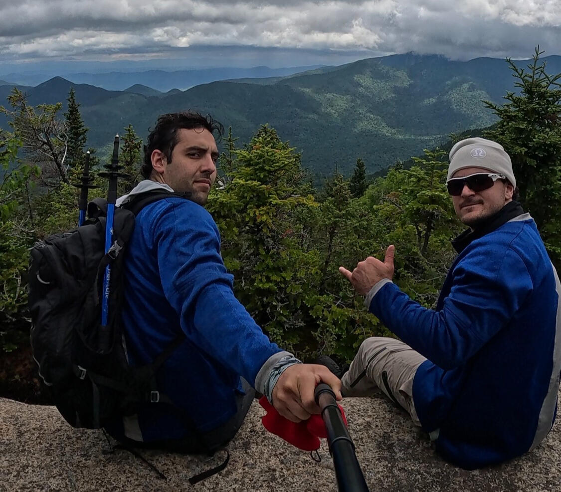
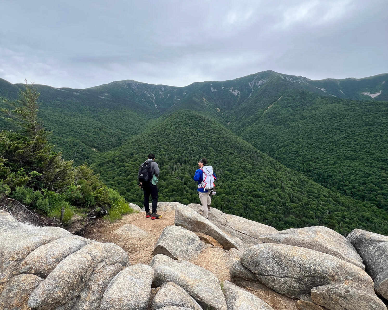
A photo of the hiking guides at The Adirondack Tool Co. - Hiking Plans, Guides, and Gear on the summit of Upper Wolfjaw Mountain in the Adirondack Mountains of New York.
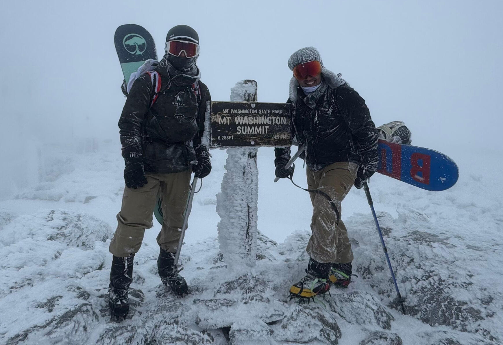
A photo of the hiking guides at The Adirondack Tool Co. - Hiking Plans, Guides, and Gear on the summit of Mount Washington in the winter.

Over the years, we've climbed mountains throughout the United States and even completed an alpine ascent in the Swiss Alps. Closer to home, we've spent countless hours exploring the Adirondack High Peaks, learning firsthand what it takes to safely and successfully plan trips in one of the Northeast's most rewarding mountain ranges.

Today, we use that experience to help others enjoy the Adirondacks with confidence. Whether you're looking for an Adirondack hiking guide, a custom High Peaks trip itinerary, help planning your first Adirondack 46er adventure, or recommendations for hiking near Lake Placid and Keene Valley, our goal is simple: help you spend less time researching and more time enjoying the mountains.
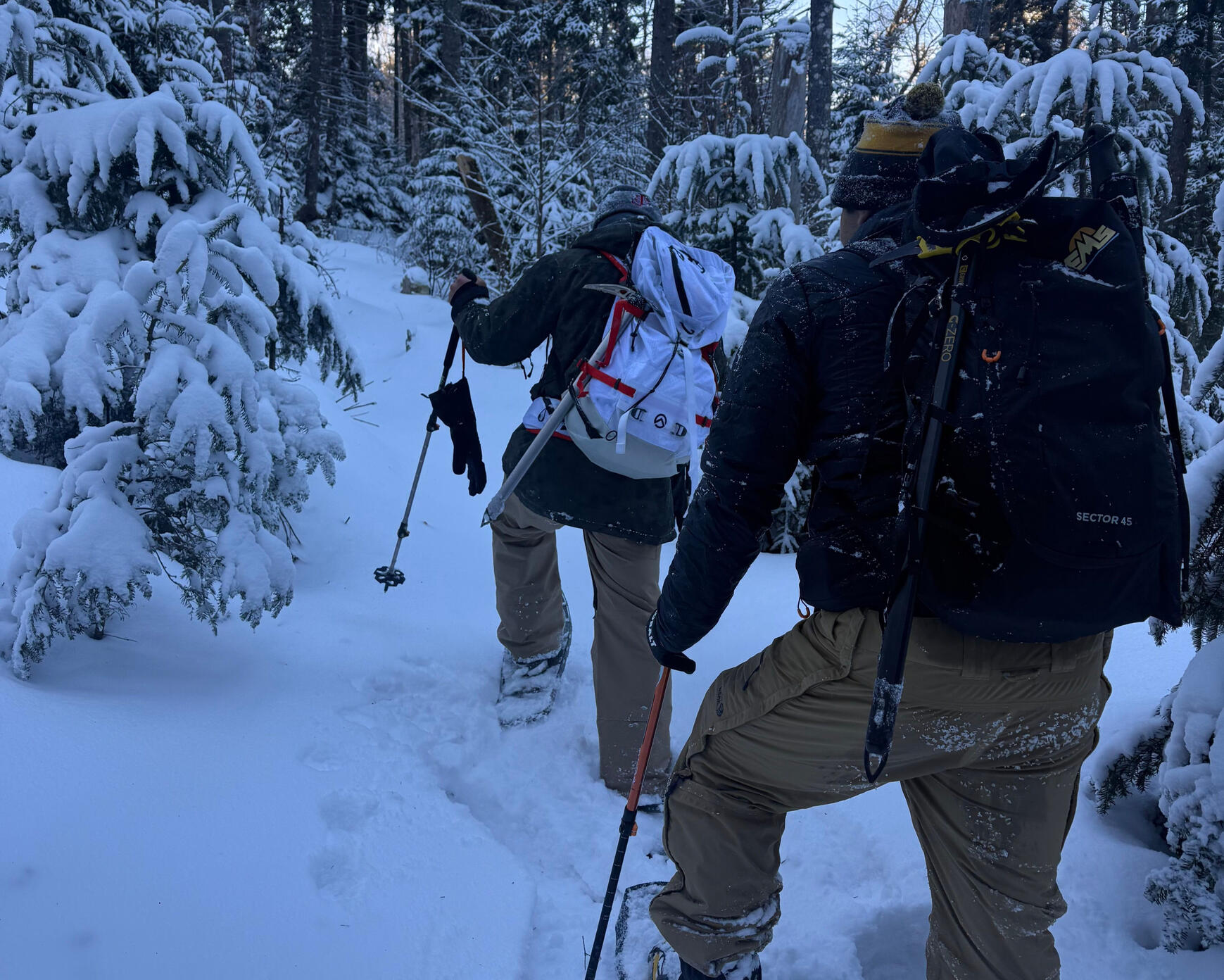
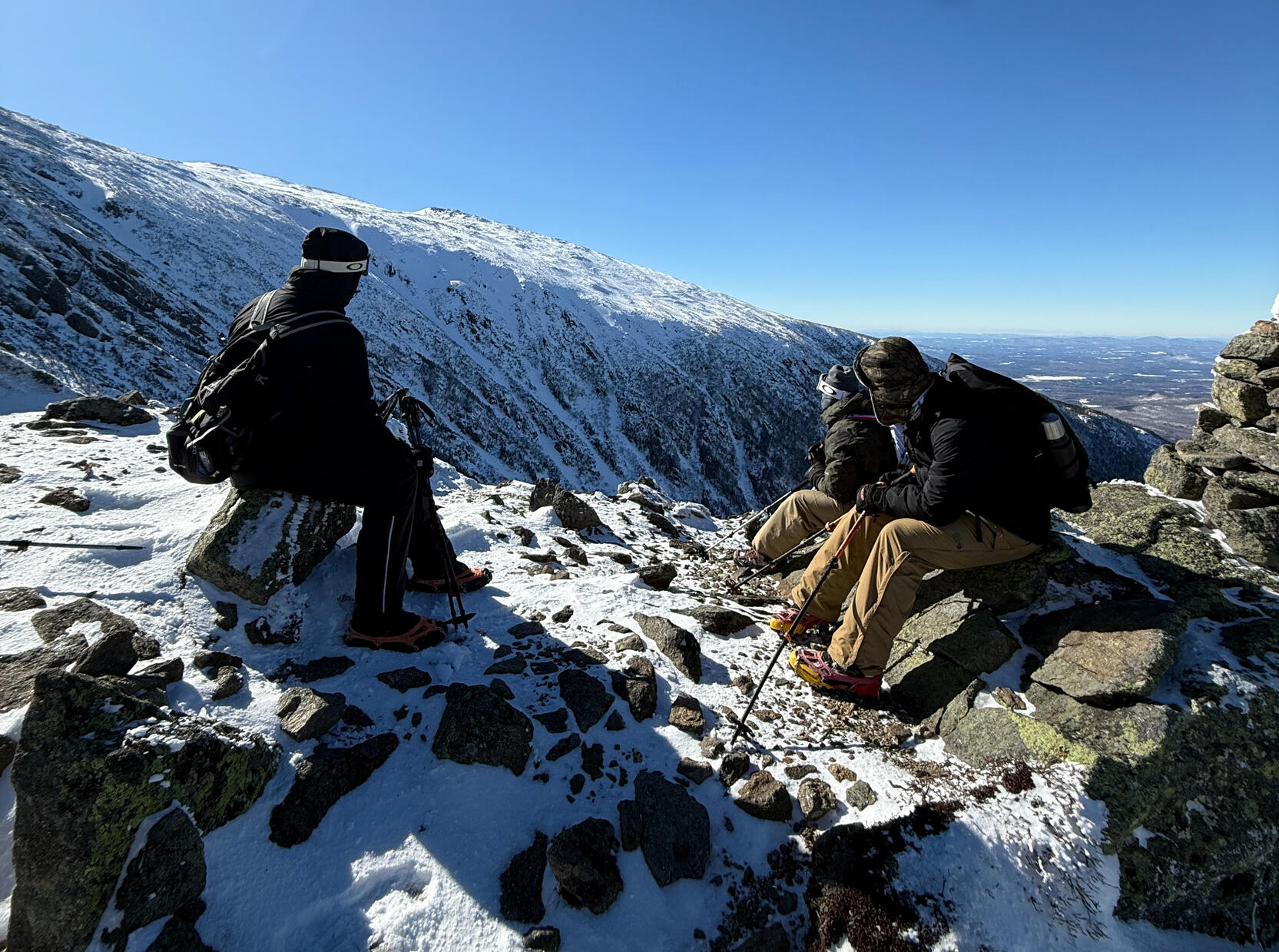
A photo of the hiking guides at The Adirondack Tool Co. - Hiking Plans, Guides, and Gear on the Phelps Trail in the Adirondack Mountains of New York.
A photo of the hiking guides at The Adirondack Tool Co. - Hiking Plans, Guides, and Gear on the Airline Trail of Mount Adams in New Hampshire

The internet is flooded with outdoor advice, but more information hasn't made the backcountry any safer. Today’s popular apps are oversaturated with conflicting reviews, exaggerated risks, and crowd-sourced guesswork that often leaves hikers unprepared. After more than a decade of navigating the coldest temperatures, deepest snow, and most remote peaks, we’ve learned that public data is no substitute for hard-earned experience - that's why we formed The Adirondack Tool Co. We’re here to cut through the digital noise. Just tell us your goal, and we'll provide a definitive blueprint on what to bring, where to go, and how to get there safely. Unlock your wild side with The Adirondack Tool Co. - Hiking Plans, Guides, and Gear.

WE ARE ASPIRING 46ERS WITH MULTIPLE SUMMITS OF MARCY, GIANT, ALGONQUIN, COLDEN, AND MORE!!!Current 46er Progress:ADK John: 13/46
ADK Damon: 12/46

A photo of the hiking guides at The Adirondack Tool Co. - Hiking Plans, Guides, and Gear on the Franconia's Ridge Trail in New Hampshire

Frequently Asked Questions (FAQ)

1. How long does it take for my order to be processed and delivered?

Orders for single-day trips will require about 12-18 hours of processing before being delivered to your inbox. If you needed guiding on a multi-day trip, it may take 1-2 days. Your order will most likely arrive ahead of both of these deadlines.

2. Do you only provide planning for Adirondack trips?

Actually, we can provide useful information for almost any route and trail in the United States. Our services are best accustomed to the Adirondacks as this is where we got our own hiking experience, but we're happy to help you work out the details on almost any outdoor adventure.

3. How will my order be delivered?

When you fill out a request form, an email address will be required. All documents and hiking plans will be delivered to that email address unless you tell us otherwise.

4. What's the best option for my first ever hike?

Our first hike ever was up Cascade Mountain, a simple 4.4mile out-and-back hiking route that gives you 360° views of the Adirondacks at the summit. We would suggest this to almost anyone as a first hike. There are few trail crossings and there are usually other hikers around, making it easy to find your way and make it to the top. If you prefer something shorter, we'd suggest Mount Jo or Coney Mountain, which also offer great views of the ADKs.

5. If I'm planning to bring my dog with me, would this affect my adventure plan?

Yes, but only slightly. Dogs require additional gear and safety precautions - just let us know if you plan to bring your furry friend and we will customize your plan accordingly.

6. Do you offer gear rentals?

At this time, we do not offer gear rentals. If the discounted gear on our store does not suit your needs, please consider shopping at the Mountaineer in Keene Valley or EMS in Lake Placid. They offer some gear rentals and have top-tier gear for purchase.

7. Do you offer guides for any other outdoor activities besides hiking/camping?

Yes, we're happy to provide information or planning services for fly fishing, whitewater rafting, skiing, and more. For general information on fishing, please check out the NYSDEC website here or Orvis' fly fishing conditions here. For general information on whitewater rafting, please check out the Adirondack Outfitters website here. Ski conditions are best observed at Whiteface Mountain's Weather Observatory here, or Gore Mountain's Conditions Report here.


Did we miss something?

We're happy to answer any questions that you have! Fill out the form and one of our teammates will respond within a few hours (likely sooner).You can also contact us via email at [email protected]
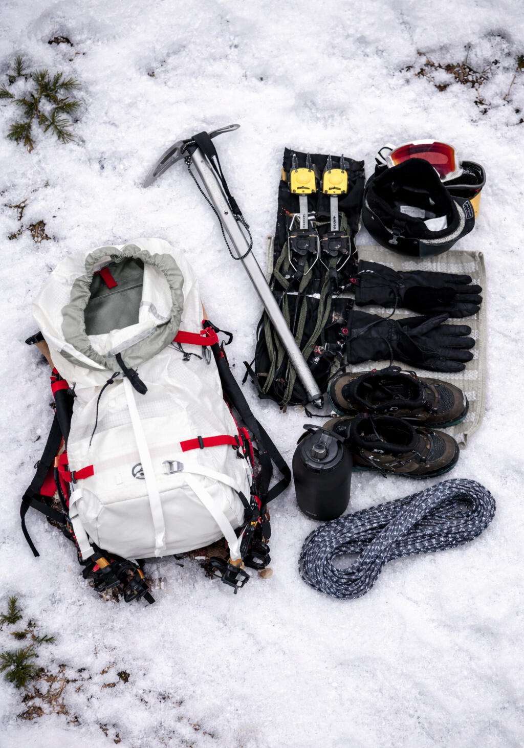
A photo of a winter gear loadout used by the hiking guides at The Adirondack Tool Co. - Hiking Plans, Guides, and Gear for Mount Washington and Mount Haystack in the winter of 2025